 Visit Athens Guide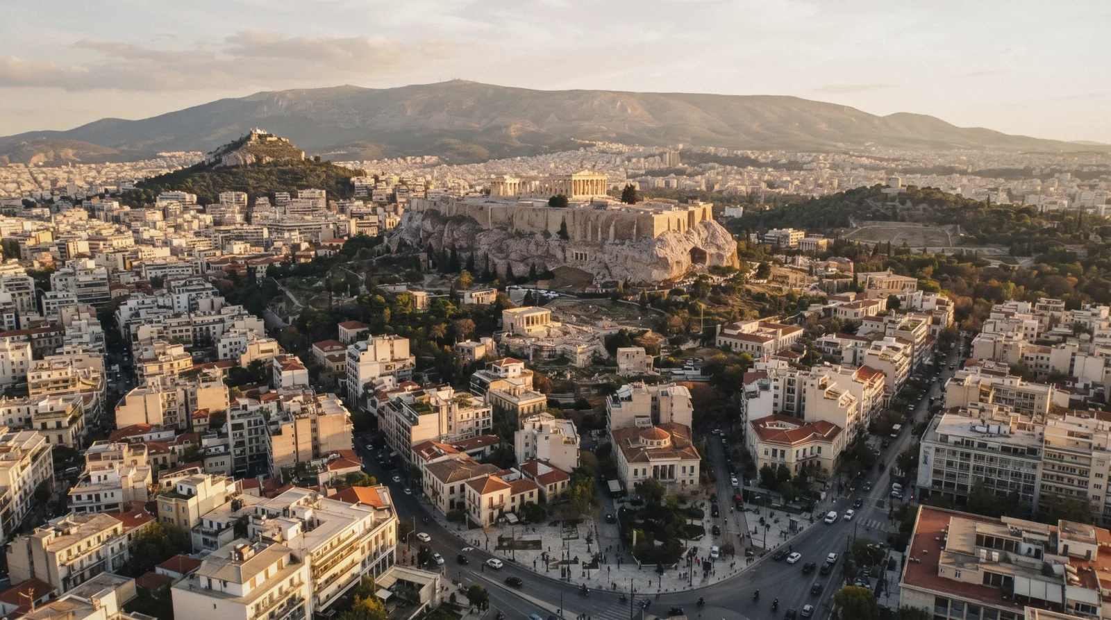
The Athens Map
This Athens map is the whole guide on one screen. Every ticketed site carries its official adult price, every free thing is marked as free, and every pin links to the page that covers it — all read on the official pages and last checked on 1 September 2026. The point of it is the scale: almost everything below is inside three kilometres, which is why this is a walking city and why the transport page matters less than it looks. Prices in one table are on the tickets hub; the wider plan is on what to see in Athens.
Quick answer How to read it, and what the distances actually are
Everything a first visit needs is inside a three-kilometre square with the Acropolis in the middle. Syntagma to the Acropolis south gate is about twenty minutes on foot; Monastiraki to the rock about fifteen; the Acropolis Museum to Plaka about nine.
Key takeaways
- The map carries a price on every ticketed pin and a link to the page behind it.
- The walking distances are the table to read before booking a hotel — they decide more than the metro does.
- Red pins are ticketed, teal are free, green are stations and districts.
- The two things that are not walks are Lycabettus and Piraeus; everything else in the centre is.
- For the day trips, which are off this map entirely, see the day trips hub.
Every Sight on One Athens Map
Forty-three places, in four colours: what costs money, what does not, where to eat, and which district or station you are standing in. Tap a chip to filter, tap a pin for the price and the page that explains it. The same forty-three are listed as text underneath, grouped and numbered, because a list can be read and a pin cannot.
Ticketed sights & museums 19 pins
- The Acropolis€30Check AvailabilityTimed entry; 08:00–20:00 in summer
- Acropolis Museum€20Check AvailabilityNo slot; Fridays to 22:00
- Ancient Agora€20Check AvailabilityCloses 19:30 in summer
- National Archaeological Museum€20Check AvailabilityOpens at 13:00 on Tuesdays
- Temple of Olympian Zeus€20Check AvailabilityShuts at 15:00 in winter
- Museum of Modern Greek Culture€15Timed entry, like the Acropolis; closed Tuesdays
- Panathenaic Stadium€12Check AvailabilityTickets at the desk only
- Museum of Cycladic Art€12Closed Tuesdays; Thursday to 20:00
- Roman Agora€10Check AvailabilityThe Tower of the Winds
- Hadrian's Library€10On Monastiraki square itself
- Kerameikos€10Listed as temporarily closed — check first
- EMST, National Museum of Contemporary Art€10Closed Mondays; free the first Thursday, 18:00–22:00
- Aristotle's Lyceum€5The cheapest ticketed site in the centre
- Lycabettus funicular€13 returnFree on foot; the ride is inside a tunnel
- Byzantine and Christian MuseumNot statedThe museum publishes hours but no price
- Benaki MuseumNot statedSee the museum's own site
- Odeon of Herodes AtticusInside the €30Seen from above by day; concerts all summer
- Theatre of DionysusInside the €30Where Athenian tragedy was first performed
- The ParthenonInside the €30No separate ticket exists
Free to visit 10 pins
- Philopappos HillFreeNo gate and no closing time
- The PnyxFreeWhere the assembly stood to vote
- The AreopagusFreeSlippery marble — use the steps beside it
- Changing of the guardFreeEvery hour, on the hour; Sunday 11:00 is the full ceremony
- National GardenFreeFifteen hectares of shade behind Parliament
- ZappeionFreeThe hall and its gardens at the south end
- Hadrian's ArchFreeOn the pavement, lit at night
- AnafiotikaFreeForty island houses on the north face; residential, go early
- The Athenian TrilogyFreeAcademy, University and old National Library on Panepistimiou
- SNFCC and Stavros Niarchos ParkFreePark open 06:00–00:00; free shuttle bus from Syntagma
Markets & eating 5 pins
- Varvakios central marketFree to walk throughMonday to Saturday; closed Sundays
- Monastiraki flea marketFreeSunday morning is the real flea market
- The grill streets, MitropoleosFrom about €4Souvlaki, standing, late
- Psyri, after nineSee the district pageWhere Athens eats dinner
- Exarchia tavernasSee the district pageCheapest eating in the centre
Neighbourhoods & metro 9 pins
- PlakaFree to walkAbout forty minutes end to end
- MonastirakiMetro Lines 1 and 3Flea market and the grill streets
- Koukaki8–12 min to the gateWhere to stay for the rock
- KolonakiFree to walkThree museums and the hill
- PsyriFree to walkDinner, after nine
- ExarchiaFree to walkCheapest eating in the centre
- Akropoli metro, Line 2€1.20The station for the rock and the museum
- Syntagma metro, Lines 2 and 3€1.20The airport line stops here
- Piraeus€1.20 by metroCheck AvailabilityThe ferry port; Line 1 or Line 3
Coordinates come from each page's own published position; district and market pins are placed on the square or street the page describes, not on a single address. Prices are the official adult rate, checked in Q3 2026. Tiles © OpenStreetMap contributors.
The walking distances that decide a trip
Our estimates between entrance coordinates, rounded up for marble, steps and wrong turns. These matter more than the metro map when you are choosing a hotel.
| From | To | On foot | Note |
|---|---|---|---|
| Syntagma | Acropolis south gate | about 20 min | Through Plaka or down Amalias |
| Monastiraki | Acropolis south gate | about 15 min | Round the east side of the rock |
| Acropolis south gate | Acropolis Museum | about 10 min | Downhill, pedestrianised the whole way |
| Acropolis Museum | Plaka | about 9 min | Flat, then stepped |
| Acropolis | Ancient Agora | about 12 min | Down the west side past the Areopagus |
| Monastiraki | National Archaeological Museum | about 25 min | Or two stops on Line 1 |
| Syntagma | Panathenaic Stadium | about 12 min | Through the National Garden, shaded |
| Acropolis south gate | Philopappos saddle | about 15 min | Uphill on stone paths |
| Koukaki | Acropolis south gate | 8–12 min | The shortest walk of any district |
| Kolonaki | Acropolis south gate | about 20 min | The longest of the six central districts |
Read the last two rows together. Every central district is within twenty-five minutes of the gate, so the walk is a tiebreak rather than a decision — which is why where to stay ranks districts by the evening and the rate band instead.
The one ticket with a place and a time on it
The cards, with the operator's own rating and review count.
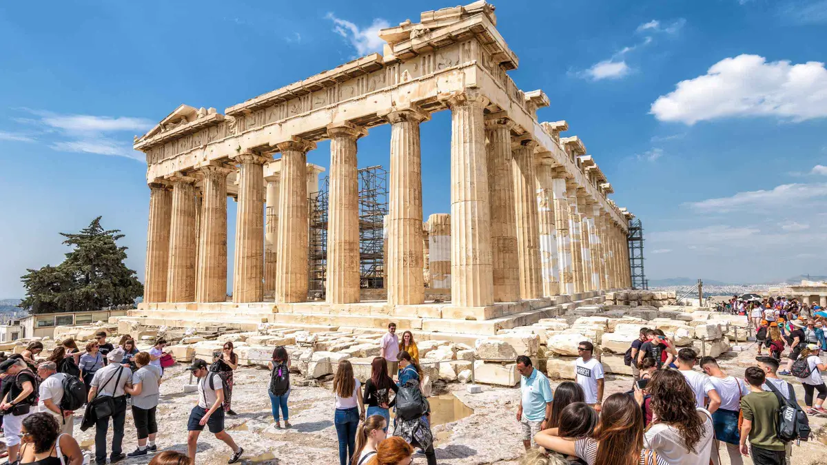 from €36
Athens: Acropolis Ticket with Optional Audio or Live Guide
Pre-booked Acropolis entry sent to your phone, with two audio-guide options and no fixed guide to keep up with. The official price is €30; this is the reseller version of the same timed slot.
Check Availability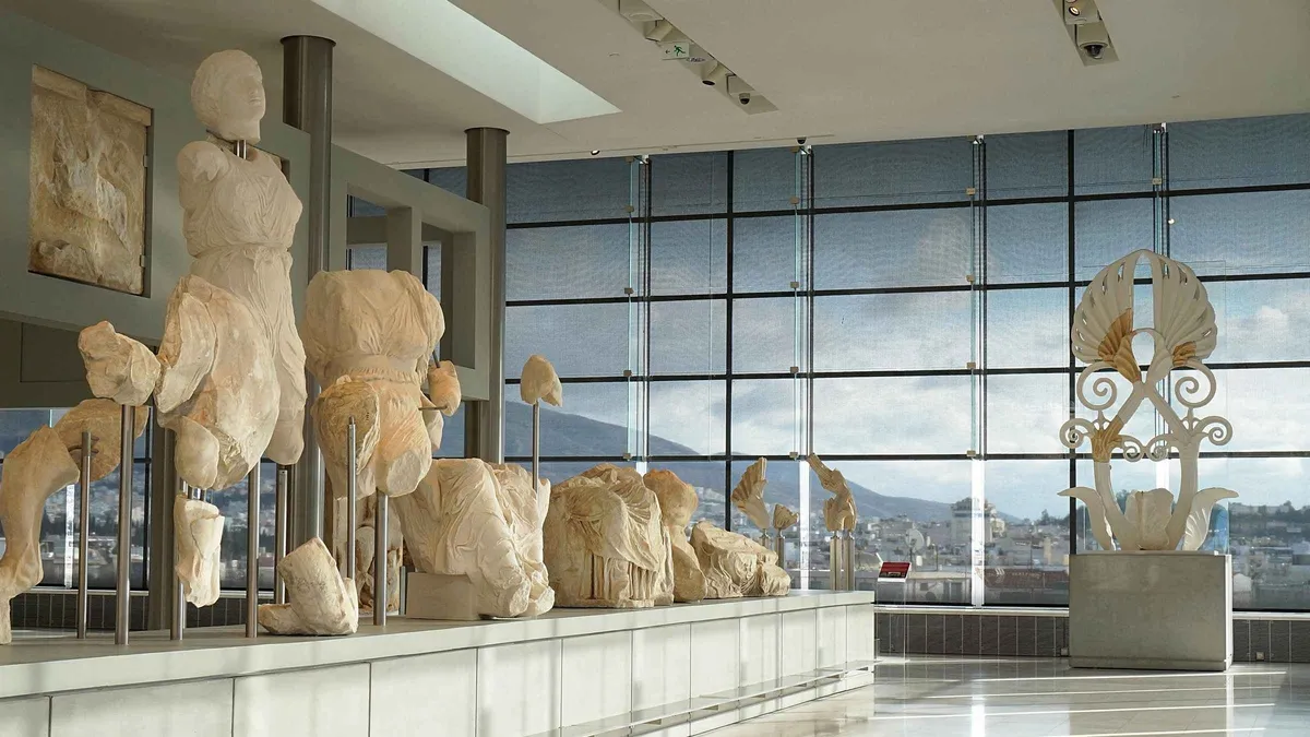 from €26
Athens: Acropolis Museum Ticket with optional Audio Guide
Entry to the Acropolis Museum with optional audio guide. The official price is €20; reduced tickets are only issued at the museum desk, never online.
Check Availability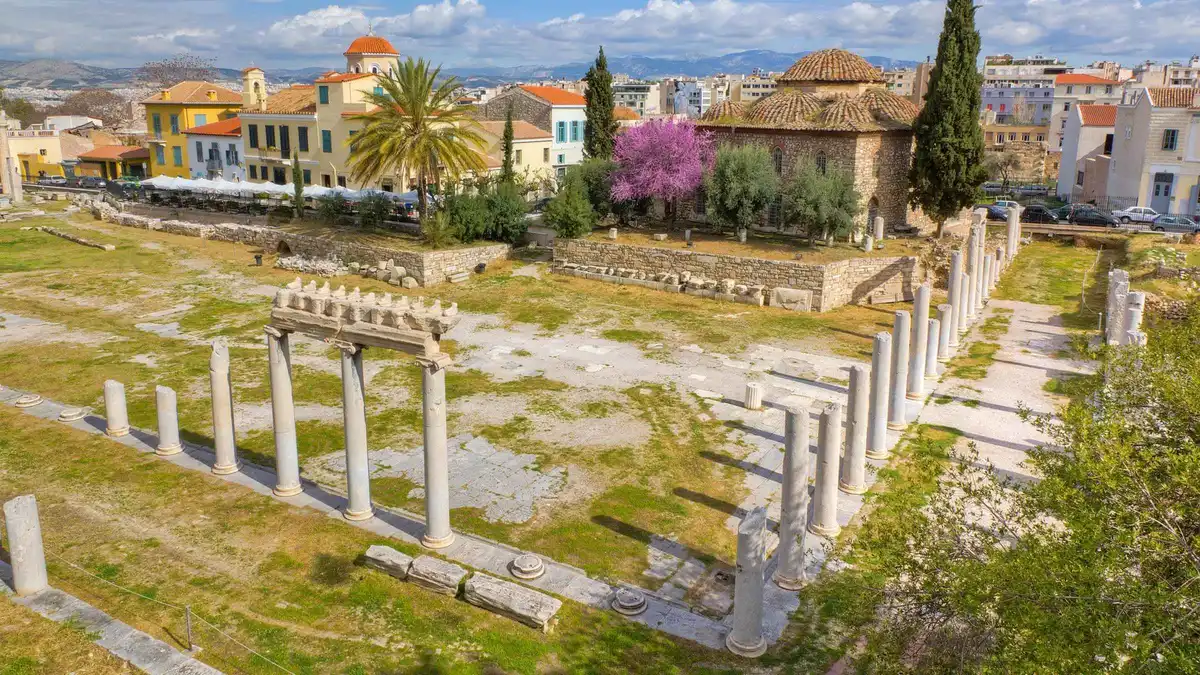 from €44
Athens: Roman Agora & Ancient Agora E-ticket & 2 Audio Tours
Time-slotted e-tickets for both Agoras with two smartphone audio tours, which is the only bundle of the two sold as one product.
Check Availability from €78.90
Athens: City Pass with Acropolis, Museums, HoHo & Transport
The Acropolis, the Acropolis Museum and a 48-hour hop-on hop-off bus in one pass, with public transport and an island cruise as options.
Check AvailabilityPrices, ratings and details are the platform's own. Euro figures are the listed prices. The platform bills in your account's currency.
How to read the map
Three things it is trying to show you.
The scale
Athens squeezes almost every red pin into a three-kilometre square, which is the single most useful fact about visiting the city. The Acropolis, both Agoras, the Olympieion, the Roman Agora, Hadrian's Library, Plaka, Monastiraki and Psyri all sit inside that one walk. A list on a screen hides it, but your legs will find it: you can leave the Ancient Agora, where the assembly, the courts and the market of classical Athens sat, and reach the Parthenon, built between 447 and 432 BC, in well under half an hour.
Only three pins break the pattern. The National Archaeological Museum, the Lycabettus funicular in Kolonaki and the port of Piraeus each need a metro ride or a taxi. Plan mornings inside the square and treat the outliers as separate trips with their own travel time.
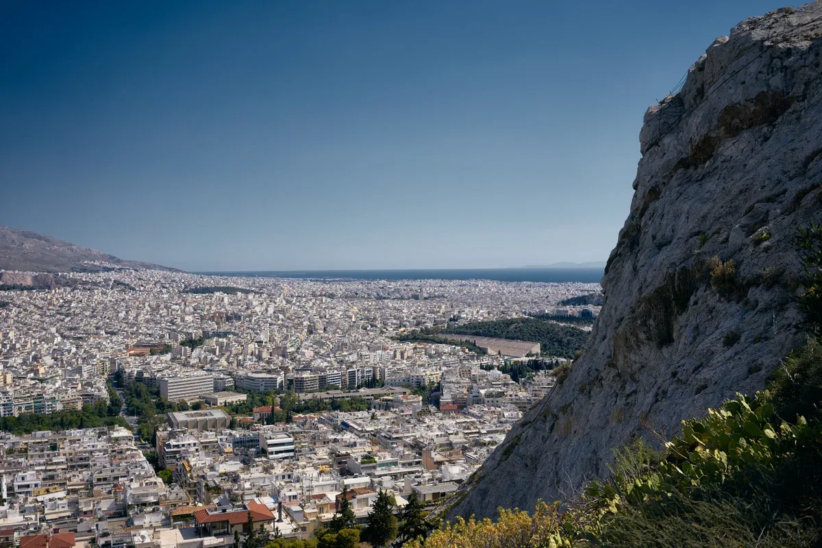
Photo: George E. Koronaios, CC BY-SA 4.0, via Wikimedia Commons
The pedestrian spine
Dionysiou Areopagitou runs along the south slope of the Acropolis and continues as Apostolou Pavlou past Thiseio, one flat car-free line linking the Acropolis Museum, the site entrance, the Odeon of Herodes Atticus, the Philopappos paths and the Ancient Agora. The street was pedestrianised in 2003 under the Unification of the Archaeological Sites of Athens programme, the scheme Melina Mercouri pushed as culture minister, and it was finished before the 2004 Games. The Philopappos paths it passes were laid by the architect Dimitris Pikionis in 1954 to 1957, out of broken marble and stone salvaged from demolished Athenian houses.
What goes wrong: the paving holds heat in summer and there is little shade, so walk it early or late. If you follow one line on this map, follow this one.
The prices
Every ticketed pin carries its official adult rate, which makes the geography of cost visible. Within five minutes of Monastiraki stand three gates: the Acropolis at €30, the Ancient Agora at €20 and the Roman Agora at €10. Nothing at all is charged on the hills, so Philopappos, with its twelve-metre Pentelic marble tomb built in AD 114 to 116, and the Pnyx, where the assembly met and voted, cost only shoe leather.
What goes wrong: state-site tickets are non-refundable, so a strike on the day costs you the full fare. The defence is two changes per ticket, allowed up to two hours before the slot. The combined-ticket page covers exactly that cluster of gates near Monastiraki.
What is not on it
The day trips sit off the edge of this map, between forty and three hundred kilometres out. Delphi is the sanctuary of Apollo, where the Pythia gave her oracles until Theodosius closed the pagan sanctuaries in AD 393. Cape Sounion carries the Temple of Poseidon, built in 444 BC, the same year as the Parthenon. Meteora needs a full day or more, its monasteries reached by rope ladders and nets when building began in the 14th century. The islands go further still. What goes wrong: these are not an hour's add-on, and a morning slot at the Acropolis cannot be combined with Delphi. The day trips hub sorts them by how many hours they take.
Athens map questions
Are the Athens sights close together?
Yes — almost everything a first visit needs is inside a three-kilometre square with the Acropolis in the middle. The distance table has the walks that matter.
How far is the Acropolis from Syntagma?
About twenty minutes on foot to the south entrance, either through Plaka or down Vasilissis Amalias past Hadrian's Arch. Akropoli station on Line 2 is closer if you would rather ride.
Do I need the metro in central Athens?
Rarely. The historic centre is a walk; the metro matters for the airport, Piraeus, the National Archaeological Museum in the heat and Kolonaki. Getting around has the fares and the lines.
Which station is the Acropolis?
Akropoli on Line 2, about twelve minutes on foot from the south entrance and next door to the Acropolis Museum. Monastiraki on Lines 1 and 3 is the alternative if you are coming from the north side.
Where are the free things on the map?
Marked in Aegean blue: Philopappos Hill and the Pnyx, the changing of the guard, the National Garden, Hadrian's Arch and the Varvakios market. All of them are open with no ticket at all.
Are the day trips on this map?
No — Delphi, Sounion, Meteora and the islands are between forty and three hundred kilometres away. The day trips hub has them sorted by how long each takes.
Where to go from here
The three pages the map feeds.
Things to do
Every central sight with price, time and booking tier: things to do in Athens.
The ranked listWhere to stay
Six districts with real rate bands and walk times: where to stay.
Once you know the distancesAthens in one day
Eight stops, six kilometres, ending on a hill: the one-day plan.
The route on the mapAthens Map on Video
Two films on the same subject, useful where a page can only describe. Ids checked on 2 September 2026.
Athens : Guide to finding the famous Instagram spots (Walking Tour of PLAKA and ANAFIOTIKA)
A walk through Plaka and the streets around it, filmed for photographs rather than history.
Video: Greece ExplainedAthens : Walking Tour of the Monastiraki & Psyri neighborhoods
Monastiraki and Psyri filmed together, which is how they are actually experienced — one runs into the other.
Video: Greece ExplainedPrices, hours and terms are set by the venue or operator and confirmed at checkout.
We may earn a commission if you book through one of our links, at no extra cost to you. Full affiliate disclosure